1810, Xl-australia New Zealand, Oceania, Fiji, Philippines, Indonesia, Hawaii, Solomon
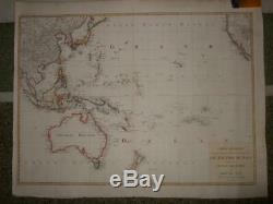
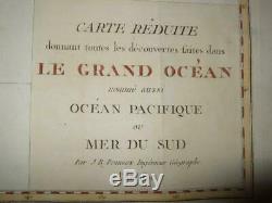
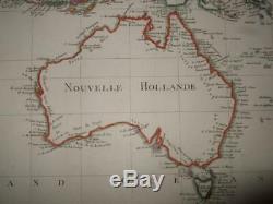
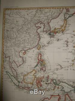
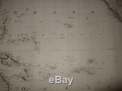
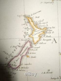
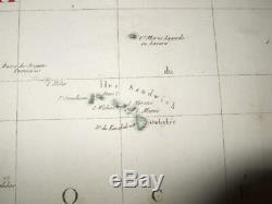
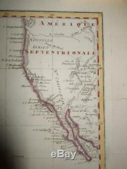
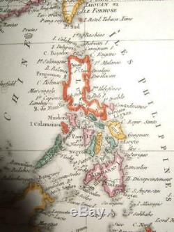

LOT OF 1 X-LARGE COPPERENGR. MAP OF AUSTRALIA, NEW ZEALAND , THE PACIFIC , WITH PARTS OF THE SOUTH-EAST ASIAN ARCHIPELAGO + CALIFORNIA, BY POIRSON , PARIS. French Australasian map, titled CARTE RED... Including Nouvelle Hollande, using the Fench names given by the Boudain expedition, eg. Terre de Napoleon, before the revision from Matthew Flinders prior exploration of the same coast.
Jean-Baptiste Poirson (Vrécourt, March 6, 1761 - Valence-en-Brie, February 12, 1831) is a French geographer and cartographer After studying mathematics and geography, he became an engineer and collaborator of Edme Mentelle. He has produced many maps. He also develops celestial and terrestrial globes, drawn and painted by hand.
Poirson differs from previous cartographers by its restitutions of physical geography, hydrographic, geological, topographical, road, territorial, administrative and statistical, and instant use of latest newly available geogr. Between 1786 and 1789, he developed a globe for the instruction of the Dauphin for Louis XVI and, between 1803 and 1811, established one for Napoleon Bonaparte. Several explorers join his services to transcribe their discoveries of voyage like Alexandre de Humboldt, Conrad Malte-Brun, François-Raymond-Joseph of Pons or Jean-Baptiste-Léonard Durand... WITH COMPLETE AUSTRALIAN COASTLINE , PUBLISHED WELL BEFORE PERON/FREYCINET AND FLINDERS! 73 X 56 CMS, , WITH GOOD MARGINS , NO WATERSTAINS, NO SIGNIFICANT FOXING , LIGHT NATURAL BROWNING OF PAPER BY AGE O, NO SIGNIFICANT SOILING.
FLATTENED FOLDS, FEW SMALL TEARS IN MARGINS ONLY. ALTOGETHER IN VERY GOOD CONDITION!! ALSO PLEASE, CHECK OUT MY. THERE ARE MORE ITEMS LISTED NOW!! NO REPRINTS OR MODERN COPIES!!!!!!!!! Be sure to add me to your favorites list.Check out my other items. The fast, easy, and secure way to pay on-line.
100 EUROS OR OVER TO MOST EC-LOCATIONS [WITHOUT EXTRA CHARGE] AUTOMATICLY [WHERE SERVICE AVAILABLE], OTHER LOCATIONS ON REQUEST ONLY. BUT PLEASE REMIND : DUE TO THE PRESENT POLITICAL SITUATION , ITEMS TO TUR.CE [OR ANOTHER EU-LOCATION] - THIS MIGHT [BUT MUST NOT] CAUSE SOME SMALL DELAY, BUT ITEMS SURELY WILL ARRIVE. VAT REGISTERED BUYERS WITHIN THE EU , PLEASE COMMUNICATE YOUR VAT.
KEYWORDS : AUSTRALIA AUSTRALIEN PAZIFIK SYDNEY AUSTRALIE INDONESIA JAKARTA JAVA MELBOURNE PERTH AUCKLAND NEUSEELAND NOUVELLE ZELANDE OCEAN MANILA BORNEO CELEBES ADELAIDE BRISBANE singapore MANILA HONOLULU SANDWICH ISLANDS. Micronesia, Nauru, Palau Papua New Guinea Samoa Tonga Tuvalu Marquesas French Polynesia Cook Islands New Caledonia Bikini Enewetak AUCKLAND.
TAHITI, VANUATU, FIJI, MARSHALL, SOLOMON, KIRIBATI PITCAIRN. Get Supersized Images & Free Image Hosting. Create your brand with Auctiva's.
Attention Sellers - Get Templates Image Hosting, Scheduling at Auctiva. The item "1810, XL-AUSTRALIA NEW ZEALAND, OCEANIA, FIJI, PHILIPPINES, INDONESIA, HAWAII, SOLOMON" is in sale since Thursday, August 15, 2019. This item is in the category "Antiques\Maps, Atlases & Globes\Australia/Oceania Maps".
The seller is "gkrgrec" and is located in NICOSIA. This item can be shipped worldwide.
- Type: Topographical Map
- Date Range: 1800-1899
- Year: 1810
- Country/Region: American Samoa
- State/Territory: Australian Capital Territory
- Cartographer/Publisher: POIRSON
- Format: Atlas Map
- Printing Technique: Copper Plate
- Original/Reproduction: Antique Original

