Rare 1825 Blueback Whaler's Annotated Chart of The South Pacific by J. W. Norie
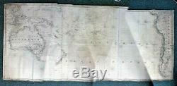
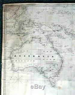
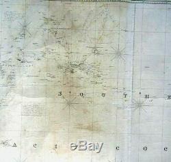
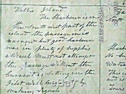
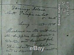
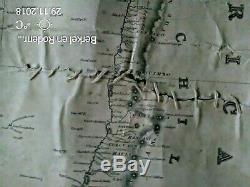
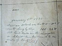
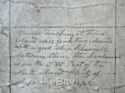
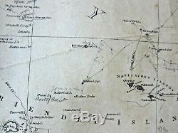
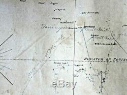


Annotated Blueback Whaler's Nautical Chart of the Southern Pacific Ocean 1825 &. Annotated Blueback Whaler's Nautical Chart of the Southern Pacific Ocean dated 1825. If you will be needing additional pictures just drop me a line.
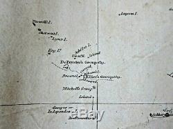
T his nautical chart was published "As The Act Directs" by J. At the Navigation Warehouse and Naval Academy, No. 157 Leadenhall Street, London on October 1st, 1825 (see accompanying inscription). The map also contains subsequently dated printed notations by various mariners dating from 1827. So this chart appears to be a subsequent edition. The printed area measures 76.5 cm by 178.9 cm on blue cloth backed heavy weighted chart paper measuring 82.2 cm by 184.4 cm (32 inches by 72 inches). I have attached to this listing a composite image of this map providing an overall view along with close-ups of pertinent chart sections of interest. Note: The top jagged edge of the composite overall image is due to an imperfect scaling mismatch of the overlapping digital images used to make the composite image and is NOT a defect in the map itself. This map is so large that it was impossible to get a single digital image of it and so I needed to resort to a composite. T he overall coverage of this map includes all of Australia, New Zealand, southeast Indonesia, the southern Philippines, various South Pacific Island Groups Tonga, Tahiti, Marquesas, Fanning Island, Galapagos Islands, etc. , and the southwest coast of South America, including all of Patagonia. The Australian coastline in well detailed with near shore depths given throughout, along with a great variety of navigational data, such as hazards, compass variations, tide speeds and reefs. A note inset within Australia (see image) is addressed to whalers, providing information on the migratory patterns of whales combined with data on currents, etc. Local depths by soundings are also shown on the map along with some printed notations by mariners that have detailed needed changes island group locations in error, etc.To the original printed chart. Thus, this chart represents an historical time capsule of known conditions in the southern Pacific Ocean in the early to mid-19th Century. Also of interest is the hand written linear plots of the vessel's locations in the eastern Pacific Ocean in the year 1856, representing a record of a whaling voyage. One notation indicates that two (2) islands shown on the chart do not exist and an island they (actually re-) discovered on the voyage was not shown on the chart this was Nassau Island, one of the Cook islands.
The coordinates of this island are written in pencil legibly on the chart. Close-up images of some typical hand written notations are shown with this listing.This chart is in very good condition for its age - now some 194 years old and counting. As the accompanying images will attest, the hand written notations on the chart are very clear and readable. Some of the tracks of the vessel have faded slightly, but are still discernable.
There is one hand stitched repair to the right side of the chart just above the port of Valparaiso, Chile on the west coast of South America (see close-up image that shows this repair) along with some very minor age related defects such as minor foxing and edge fraying - but nothing major. The item "Rare 1825 Blueback Whaler's Annotated Chart of The South Pacific by J.
Norie" is in sale since Wednesday, May 29, 2019. This item is in the category "Antiques\Maps, Atlases & Globes\Australia/Oceania Maps". The seller is "stevesgeneralstore" and is located in berkel en rodenrijs. This item can be shipped to North, South, or Latin America, all countries in Europe, all countries in continental Asia, Australia.- Cartographer/Publisher: John William Norie
- State/Territory: Australian Capital Territory
- Original/Reproduction: Antique Original
- Type: Nautical Map
- Year: 1825
- Date Range: 1800-1899
- Country/Region: Pacific Ocean
- Era: 1800s

